Exploring places virtually
Crevue provides easy access to business critical information for facilities, places or physical objects
Enhance your planning efficiency, achieve greater precision in engineering, and minimize the need for physical site visits by incorporating real-world spatial data into your office environment. We support laser scanning data, BIM/CAD, photorealistic meshes, spherical panorama photos, and more to accurately depict the physical asset. All data is securely stored in the cloud and streamed on demand to users, providing unique insights into the asset.
Who is it for?
For content providers, like laser scanning service providers, who require a solution for hosting and publishing scan data for their clients
For asset owners who possess spatial information about their own facilities and need to provide insights for affiliated partners or contractors
Immersive
High-fidelity spatial data seamlessly integrated into a robust 3D environment
Available
Accessible from anywhere in the world, with support for multiple platforms
Secure
Securely stored and hosted in the cloud, protected by multi-factor authentication
Applications

Process industry
Reduce the need for site visits. Achieve accurate clash free retrofit designs. Laser scanning technology has been used in the industry with great success since 2001.

Civil engineering
Utilized by architects and engineers who require accurate as-built information.

Marine
Laser scanning is extensively utilized in retrofit projects to ensure precise engineering and minimize time spent in dry dock.
Multi platform
Install Crevue as a desktop application for Windows or Mac, or use it through any browser on any device. Crevue is designed to be easily accessible across platforms and devices, providing a consistent user experience regardless of the method you choose.

Supported data types
Crevue supports a wide range of content types to optimally represent the physical asset.

Point clouds

CAD / BIM models

3D floor plans

Laser scans

Panorama photos

2D floor plans

Colored meshes
Showcases

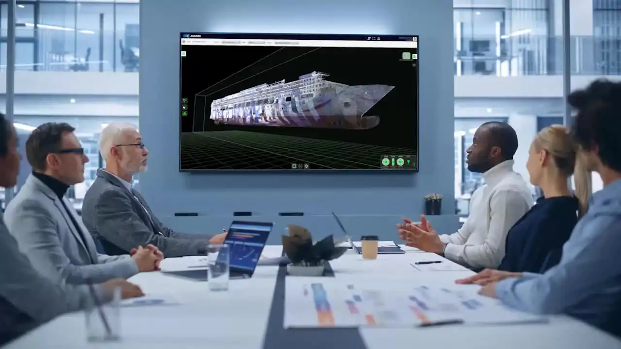
MS Norwegian Dawn
Scanned while in dry dock, approximately 170 scans offer a highly detailed documentation of the ship's hull

Kristianslyst Jr High School
Our most comprehensive demo includes BIM models, scans, panoramas, point clouds, and 2D and 3D floor plans

Polar Pioneer drilling rig
Laser scan data combined with a photogrammetry model captured using an SLR camera

Newsletter
Receive the latest updates from us in your email.
Closed beta testing program
Our software is currently undergoing evaluation by professionals worldwide in a closed beta test program. The official public release is scheduled for Q2 2026.
Please subscribe to our newsletter to get notified when services go online!
